Oruxmaps, The App thought for forestry works
Forestry jobs are not easy. We find different difficulties in the field, others due to climatic conditions and, above all, on the access. Something as seemingly simple as getting to the working area becomes really complicated when the slope is high or the vegetation is very dense and even more, when we have to make footpaths and loaded with all the instrumentation, maps or heavy equipment. Because of these problems, Forest World Magazine wanted to test the Oruxmaps App and see if it can adapt to the needs of the forestry works.
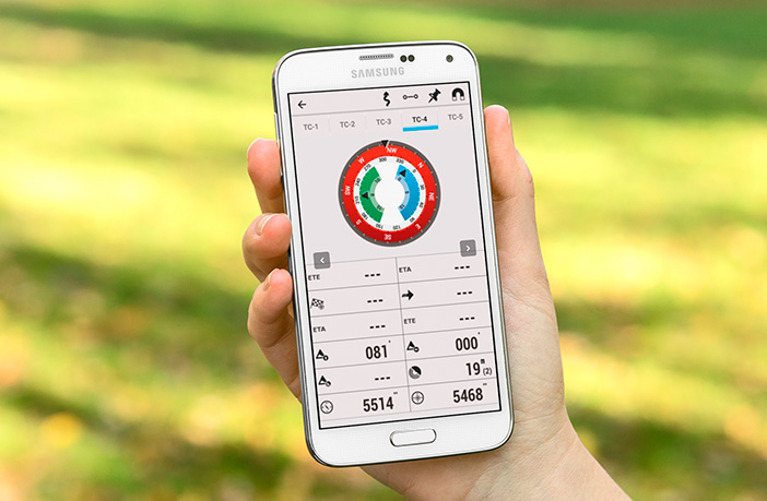
The App is an Android application and can be downloaded free of charge on the developer’s own website, and it allows us to perform different great utility tasks in addition to its use as a navigator, with a quite complete free cartography, possibility of creating offline cartography, uploading and downloading routes, in addition to being able to create them by waypoints (points of interest) that are georeferenced and you have the possibility to add them photographs, audio files or videos and, to work safely, allows you to share your position with other people who use the App, which seems to be very helpful when we are doing forest inventory or wildlife monitoring as it allows to work with a bigger dispersion of the working team.
For our test we moved to the Alto Tajo Natural Park (Spain) and made different routes for 5 days. As support, we use a mid-range Smartphone (Aquaris BQ) and as a reference a GPS Trimble precision and the Google Maps navigator.
On the road, the app behaved correctly, but once we start offroad routes and go to forest tracks when we can really see the full potential of the App, providing accurate navigation even with adverse weather such as snow or wind and, having below the meter precisions in finding the different waypoints, even under the worst circumstances, under close canopy and wind.
After this test, we can highly recommend this tool because of all the benefits it offers, it could replace the heavy and uncomfortable GPS in our work in the works that aren’t necessary high precision data, in addition to being much more versatile and cheap.
We just encourage you to try it by yourselves and visit their website (www.oruxmaps.com) where you can download the App along manuals in different languages.


